NPE-Spot1

Adelaide Intl. Airport – Spotting Guide
September 7, 2019
London Stansted Airport – Spotting Guide
September 14, 2019
Adelaide Intl. Airport – Spotting Guide
September 7, 2019
London Stansted Airport – Spotting Guide
September 14, 2019Napier Hawke’s Bay Airport – Spotting Guide

Napier Hawkes Bay Airport (NZNR/NPE) is the main airport serving the cities of Napier and Hastings in the Hawkes Bay region of New Zealand. NPE served approximately 700 000 passengers last year which makes it the 7th busiest airport in New Zealand. NPE is situated 4km northwest of the city of Napier. The Hawkes Bay region of New Zealand is famous for its wine production, so a visit to this area is highly recommended if you enjoy your wine. Napier is also known around the world for its Art Deco architecture in the city centre, due to there being a massive earthquake in 1931 which destroyed most of the city, and the subsequent rebuilding took place when Art Deco was all the rage. The land that the airport sits on today was actually brought above sea level by the 1931 earthquake!
Because of these two facts, Napier is a great place to visit while on holiday in New Zealand, so why not make a stop at the airport as well. There are a few locations in and around the airport where you can get photos of the aircraft serving the airport. The dominant carriers are Air New Zealand Link with their Bombardier Dash 8 Q300s and ATR72s, as well as JetStar with their Q300s. However, the airport is also served by Air Wanganui with Beechcraft King Air B200s, as well as Sounds Air with Pilatus PC-12s. The airport is also home to Hawkes Bay Air Ambulance, which is operated by Skyline Aviation. This company has a varied fleet of King Air C90s, Cessna Citation Mustangs as well as a Cessna Citation Sovereign. They are regularly flying into and out of NPE on medevac flights all around New Zealand.
NPE has 2 runways, namely 16/34 and 07/25. During my visit, only 16/34 was active, and 07/25 was used as a taxiway. Another thing that is noticeable is that when the wind is calm, both sides of runway 16/34 can be active at the same time, with some flights landing on runway 16 and others on runway 34. This can make life tricky, but the planes generally land and depart straight in and out from wherever the origin/destination is. In other words, a flight from Auckland may arrive on runway 16, yet a flight from Wellington can arrive on runway 34, just a few minutes after the Auckland flight arrived. Regardless, the light conditions at the airport are fantastic due to the clear coastal air so the photos you do end up getting will turn out to be excellent.
Written by Timothy Brandt. Last update March 2019.
| Rating | |
| Movements | |
| Airline Variety | |
| Photo Locations | |
| Weather | |
| Airport Information | |
| Runways | |
| 16/34 | 1,750m (5,741ft) – Asphalt |
| 07/25 | 1,199m (3,934ft) – Asphalt/Grass |
| Terminals | |
|
–
|
There is only one terminal handling all flights.
|
| Spotting Information | |
| Ladder | Not needed. |
| Car/Public Transport | No public transport to the locations but from the terminal locations 1-3 can beach reached by foot. |
| Restrooms | In the terminal. |
| Drinks/Food | There is a small canteen inside the terminal where you can buy food and drink, otherwise not much in the immediate vicinity around the airport. |
| Hotels | No hotels immediately around the airport, but there are a few guesthouses in the suburb of Westshore about 2km east of the airport. |
| Season | Winter has generally very poor weather. Best times would be February-April and October-November. December-January is very hot and heat haze will be an issue. |
| Runway Usage | |
| General Information | Both sides of runway 16/34 can be used at the same time when the wind is calm, as flights will depart in their intended direction in order to save time. In other words, a flight heading south to Wellington will use runway 16 for departure, however a flight heading in a northerly direction to Auckland will more than likely use runway 24 for takeoff. Obviously if the wind is indeed blowing more strongly and it is favouring a particular side, then that side will be the primary runway in use. Runway 07-25 is generally never used for takeoffs and landings and is used mainly as a taxiway. |
| Spot #1 – Turfrey Road – Arrivals runway 16 | |
|---|---|
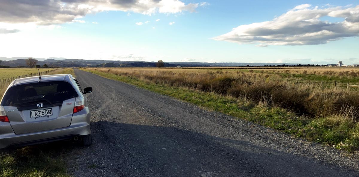
| WHERE | From the terminal, follow the road that takes you to Main North Road/State Highway 2. Turn left at the traffic circle and drive along the road for about 1.7km. You will see a small gravel road to the left. Turn left onto this road, called Turfrey Road. Park your car anywhere off the road where there is space and stand wherever you want to choose the angle that best suits your preferences. For the afternoon side, just simply walk along the road to the west and pick a spot that suits you best. By foot you can easily walk from the terminal along the perimeter. |
| What | Aircraft on short finals for runway 16. Usually used by arrivals from Auckland in calm wind conditions. Most other traffic arrives from the south. |
| TIME | Morning side: Sunrise until 11am. Afternoon side: 1pm until sunset. |
| MISC. | Nothing available around here, so bring what you need with you. The road is gravel, so be careful when other cars and trucks drive past as they will kick up a lot of dust and it might get onto your camera sensor. Also, the sample photos were taken from the afternoon side, however the morning side is much the same with regards to the angle and focal length needed. |
| FOCAL LENGTH | ATR72: 200mm. PC-12: 280mm. |
| Spot #2 – Hawkes Bay Air Ambulance/Skyline Aviation ramp | |
|---|---|
| WHERE | From the terminal, follow the road that takes you to Main North Road/State Highway 2. Turn left at the traffic circle and follow the road for 1.1km. You will see the Hawkes Bay Air Ambulance hangar on your left hand side. Park your car at the marked location on the map and follow the line drawn. You will be walking along a cycle path so be careful of cyclists. Walk anywhere along the cycle path to get the best angle of the aircraft parked outside. By foot you can easily walk from the terminal along the perimeter. |
| WHAT | Aircraft parked on the ramp outside the Hawkes Bay Air Ambulance hangar. These aircraft belong to Skyline Aviation. When I visited, the only aircraft parked outside was ZK-RXD, a Citation Sovereign. |
| TIME | 10am – 3pm |
| MISC. | There is nothing around you so take what you need. |
| FOCAL LENGTH | Citation: 135mm. Other aircraft may be smaller or further away but 250mm will be more than enough. |
| Spot #3 – Terminal – Aircraft taxiing to/from runway 16/34 as well as ramp shots. | |
|---|---|
| WHERE | Inside the terminal, there is a big window just to the left of the single boarding gate. There are plenty seats facing the window so grab a seat and take some photos while waiting for your flight. The spot is landside so you can go sit there any time you would like. |
| WHAT | Morning photos of aircraft taxiing to/from runway 16/34 as well as those on the ramp. |
| TIME | From sunrise to 11am. |
| MISC. |
At this spot the photos are taken through glass with a tint, which can be corrected in most editing software. Be careful of glare on the windows. Everything you need is just a few meters away from you in the terminal.
|
| FOCAL LENGTH | You are very close to the aircraft here. For the ATR72 in the example photos: Taxiing = 60mm; Turning = 35mm; Parked = 18mm. |
| Spot #4 – Windsock Road – Arrivals and departures runway 16/34 as well as aircraft backtracking for departure on runway 34. | |
|---|---|
| WHERE | From the terminal, follow the road leading to the intersection with Main North Road/State Highway 2. About 300m before you get to the traffic circle, turn right onto Pump Road and follow the road until it bends to the right. Follow this road for another 500m and it bends to the right again. You will now be on Windsock Road. Carry on along Windsock for another 600m until you are parallel with the threshold of runway 34. Park your car slightly off the road where there is space and position yourself anywhere along the road to find an angle that suits your preferences. |
| WHAT | Probably the best spot at the airport. Afternoon shots of aircraft departing runway 16, landing on runway 34, taxiing on the runway while backtracking for departure on 34 as well as departures on runway 34. You also get a nice backdrop of the Napier Bluff in the background in some shots. |
| TIME | From 1pm until sunset. |
| MISC. | The roads around here are all gravel, so be careful of dust when another car drives past. Also keep in mind you are on private property so if someone asks you to leave, please do not hesitate. However, the people around here are very friendly and generally have no problem with you being there. I visited this spot at least 5 times during my visit to the area and not once was I asked to leave. |
| FOCAL LENGTH | ATR72 & Dash 8 departure shot = 160mm
Dash 8 turning = 180mm King Air B200 = 280mm PC-12 = 300mm |


There is a local bus which goes close to the airport (Westshore……..it’s on the bottom left of the map above)
https://www.gobay.co.nz/timetable/route-15