JMK-Spot1
Den Helder Airport – Spotting Guide
May 20, 2019
Raleigh Durham Intl. Airport – Spotting Guide
May 27, 2019
Den Helder Airport – Spotting Guide
May 20, 2019
Raleigh Durham Intl. Airport – Spotting Guide
May 27, 2019Mykonos Airport – Spotting Guide

The airport of Mykonos is located in the southwest of the famous holiday island, about 4 km from the island capital of the same name on a slightly sloping plateau. During the summer season JMK is served by many European airlines also known from other holiday destinations but even from airlines you don´t expect here like Qatar Airways with A320. The number of flight movements is limited due to the only runway 16/34, to lack of taxiways and the small apron. During two stays in 2013 and 2016 the A320 and B737 were the largest aircraft types. In addition, bizjets and small planes up to the Cessna 172 from all over the world as well as occasional helicopter flights could be spotted. Photographically documented are visits of Herkules C130 transport aircraft of the Greek Air Force.
Good for spotting is actually only the southern half of the runway, where it is surrounded on both sides by slightly to significantly elevated terrain. In this area the runway is bypassed by a public road, where all photo points can be easily reached. The rocky and stony ground however requires good footwear. Because of the wind coming mostly from the north in the summer (Meltemi) you are always close to the action at the beginning of Rwy 34. The northern half of it partly is on the same level, and then even higher than the surrounding area. From the direction of the runway the best photo opportunities are from sunrise to mid-morning and from mid-afternoon to sunset. The time of 5 – 6 hours in between can and should rather be spent at the beach or pool.
Below I describe 6 photo points, the status of the information is summer 2016. Therefore, certain places could be usable no longer or only under other circumstances (ladder, etc.). Current updates are therefore welcome! It is important to know that at individual photo points you are standing on the remains of dilapidated buildings or on stone walls, and the terrain is rocky. See the related notes at the spots concerned. We expressly point out that every climbing and trespassing is at your own risk! Should you be found crossing private property by the owners, be polite and try to explain why you are here.
For an exact timetable visit the official airport website.
Written by Martin Oswald and Dimitri Gabriel (Spot 2). Some pictures provided by Mattia De Bon. Last Update: Summer 2021
| Rating | |
| Movements | |
| Airline Variety | |
| Photo Locations | |
| Weather | |
| Visitor Rating How was your trip? Rate this airport! |
[ratings] |
| Airport Information | |
| Runways | |
| 16/34 | 1.900m Concrete |
| Terminals | One for all flights, open parking positions, no passenger boarding bridges. |
| Spotting Information | |
| Ladder | Could be necessary for some places, possibly even 5 steps. See the individual descriptions. |
| Car/Public Transport | Since there is no public transport in the area in question, we recommend the hire of a vehicle: As practical proved a small motorcycle or a Quad/ATV (on the Greek islands very common), if you have no ladder. This makes it easier to park in narrow places on the edge of the road. In principle, all photo points can also be reached from the airport on foot, but then you have to carry everything with you for lack of other shopping. The airport is connected to the town of Mykonos by public buses, taxi fares are in the usual range. |
| Restrooms | Only available in the airport. Due to the summer-heat and the often lively wind you should have enough drinking water. |
| Drinks/Food | Only at the terminal. |
| Hotels | The AC Village Christoulis (Spot 2) offers a wonderful sight of the airport. Appartments, villas and houses around the airport are available as well. |
| Season | May to October, best months July to mid-September with most charter traffic. This is a holiday distination and it´s pretty quiet here during the winter season. |
| Runway Usage | |
| 16/34 | With the wind coming from the north (Meltemi) almost always Rwy 34. |
Due to “security concerns” the greek government told google to pixelize the satellite images of all airports in greece with military movements. That is why you don´t see all positions as clear as usual. A good alternative is Microsofts Bing Maps where the airports in Greece are still visible…
| Spot #1 – Garage / shelter next to the terminal | |
|---|---|
| WHERE | Where: Coming to the intersection at the terminal exit keep left towards Ano Mera, past a relatively new rental car park. Take the second turn again left onto a gravel road to a small stone built shelter. The roof of this shelter / garage is the photo point, behind it is the fence of the airport. It was already in a pretty bad condition in 2016, so beware! You can also stand on the stone walls, which is less comfortable. If both are impossible, you would need a relatively high ladder (5 steps). |
| WHAT | All movements in the southern part of the runway. During landings on Rwy 34, aircraft have usually touched down and the thrust reversers are open. Larger aircraft roll past the terminal and then turn around. If they use the southern entrance of the apron, you can take another shot with larger focal length before they taxi in. |
| TIME | Afternoon to sunset. |
| MISC. | Terminal nearby, good shoes to climb the shelter! |
| FOCAL LENGTH | 35 – 200mm |
| Spot #2 – AC Village Christoulis | |
|---|---|
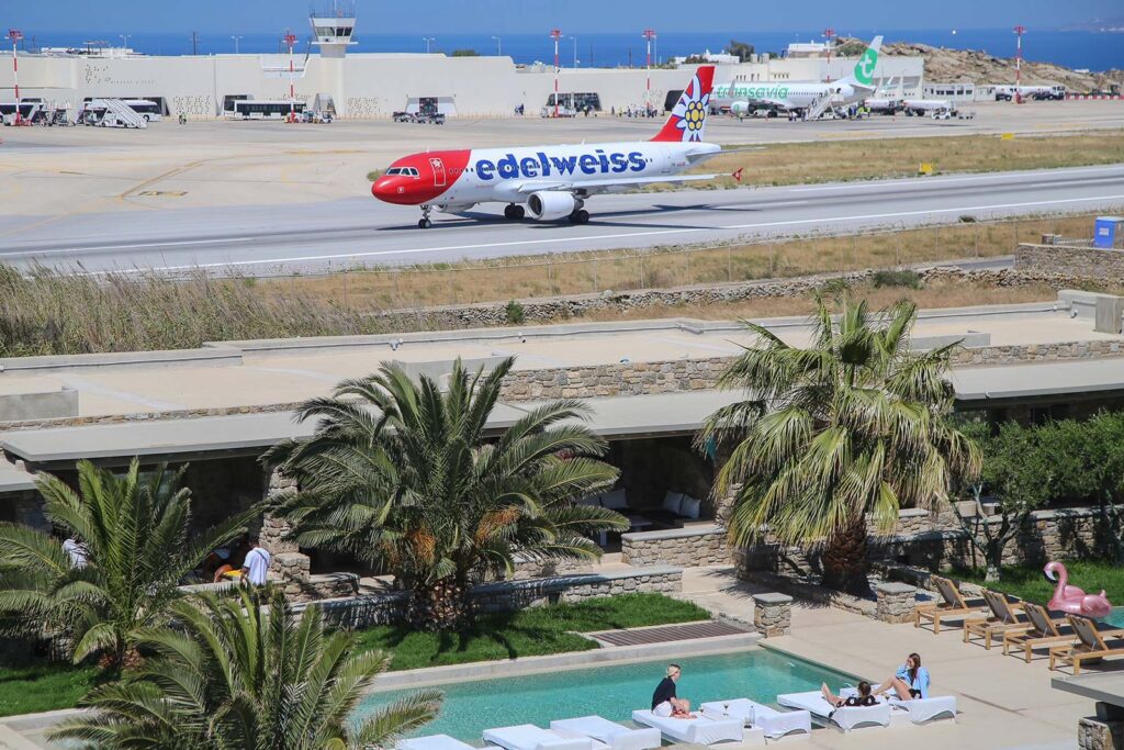
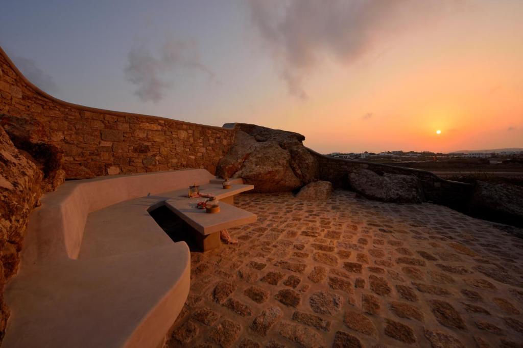
| WHERE | On the opposite side of the terminal, directly next to the runway there is a pretty new hotel name “AC Village Christoulis”. The rooms itself don`t offer a sight of the airport but the hotel has a nice open air terrace with a perfect sight of all the action. |
| WHAT | All movements on the runway and taxiway. |
| TIME | Sunrise to midmorning |
| MISC. | Everything you need within the hotel complex. |
| FOCAL LENGTH | Transavia 738 = 200mm; Qatar A320 = 280mm; Falcon = 400mm+ |
| Spot #3 – On the road to Ano Mera | |
|---|---|
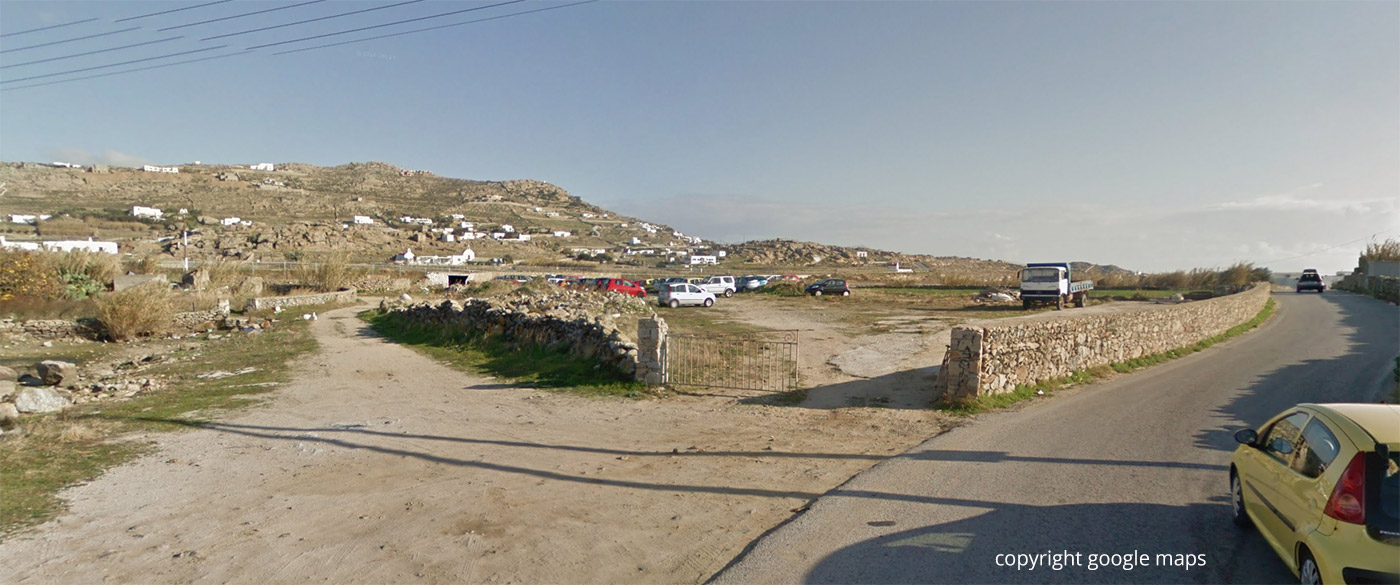
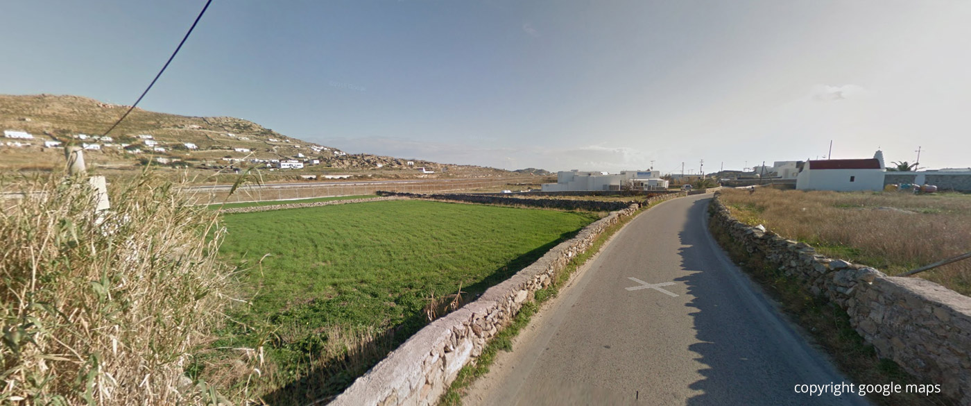
| WHERE | From the terminal on the road towards Ano Mera about 200m. Park your vehicle in the bay on the right at the entrance to a private property. The stone walls to the left and right of the street serve as photo points. You should be high enough so that the airport fence is below the landing gear. Alternative: A ladder to shoot directly along the fence, but do not leave it up all the time to avoid issues with the security! |
| WHAT | All movements in the southern area of the runway. |
| TIME | Afternoon to sunset. |
| MISC. | Nothing there, terminal not far away. |
| FOCAL LENGTH | 50-300mm |
From the street on the stonewall:
From the fence with a ladder:
| Spot #4 – Near a private property at the beginning of Rwy 34. | |
|---|---|
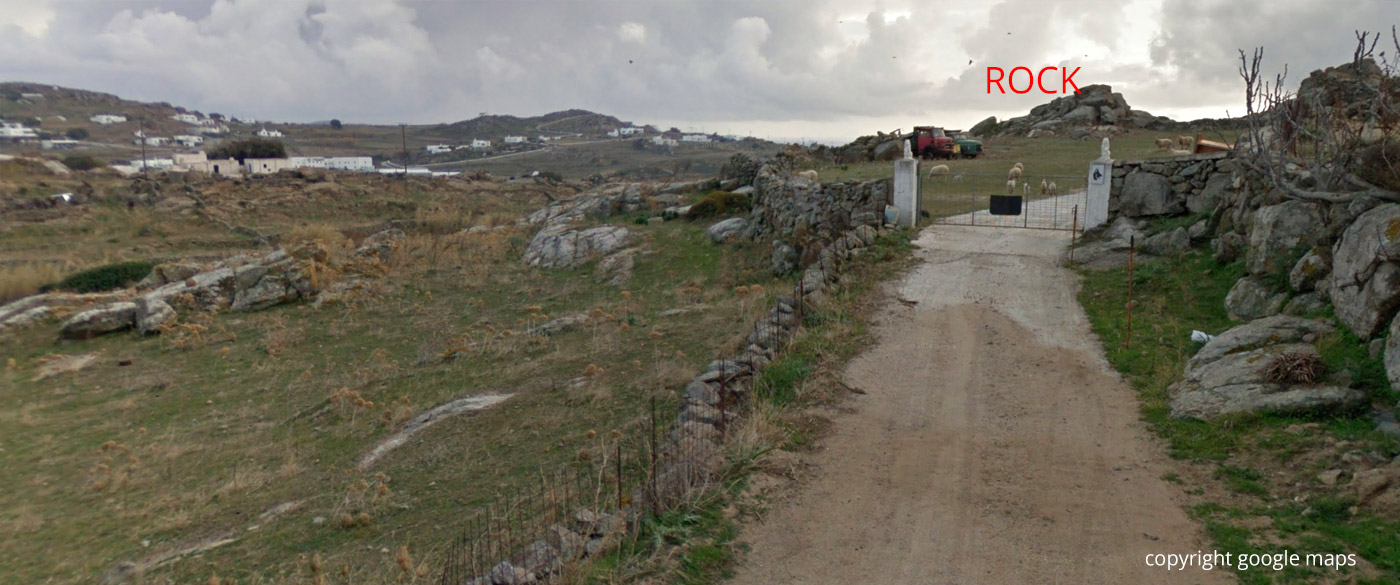
| WHERE | Driveway red marked on the map. The turn-off to the side road is in front of the left-right S-curve of the main road towards Ano Mera. Park your vehicle in the bay on the left at the end of the solid red line on the map and walk to the entrance gate of a private property. If this gate is open, you can just go through the property in the direction of the raised rocks visible just behind it on the google streetview image (straight blue line on map). In front of the rocks is a low stone wall, get over it and leave the private property. Climb up the rocks and you’re there. If the gate is closed, or signs prohibit entry, try to avoid the property left along the stone wall. You should get as close as possible to the mentioned rocks and as elevated as possible. Between you and the runway is a power line – you have to find a position where this is clearly below the landing plane. Maybe that is already the case at the point in front of the entrance gate, I did not try it. In case of doubt, wait for a landing to assess the situation. |
| WHAT | Very short final Rwy 34. |
| TIME | Afternoon to sunset. |
| MISC. | Good footwear required! |
| FOCAL LENGTH | 125 – 180mm |
| Spot #5 – Derelict building at the beginning of Rwy 34 | |
|---|---|
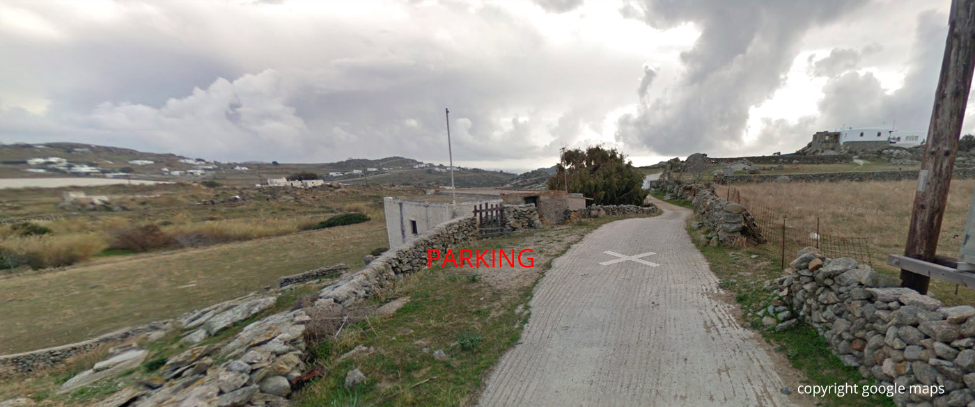
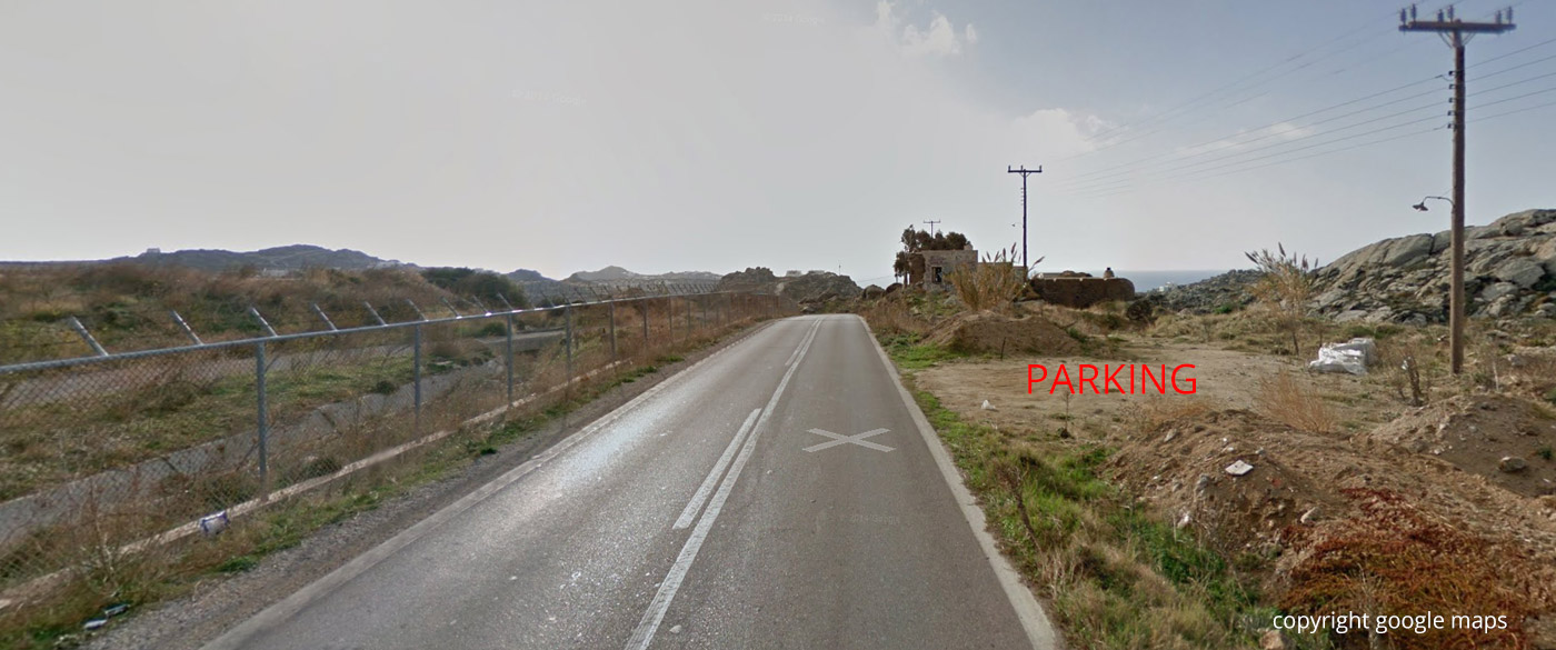
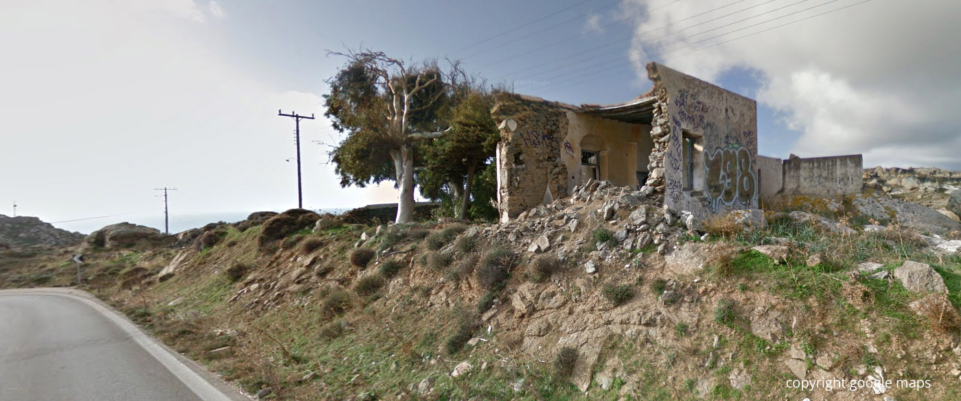
| WHERE | Like to spot 4, but follow the s-curve along the main road towards Ano Mera almost until it turns left at the end of the runway. Park in the bay on the right and continue to the derelict building. Approximately under the power line is a concrete cuboid building part. This is the photo point. |
| WHAT | Line-up Rwy 34. Grass and bushes could obscure parts of the landing gear. If you hit the trigger at the right moment this problem can be mastered. Landing aircraft tend to be too high. |
| TIME | afternoon to sunset. |
| MISC. | Be careful when climbing, good shoes! If the ruin no longer exists, a ladder would be necessary, you should be so elevated that you get slightly above the level of the runway turntable. |
| FOCAL LENGTH | 35 – 85mm. |
| Spot #6 – Rocks at the beginning of Rwy 34 | |
|---|---|
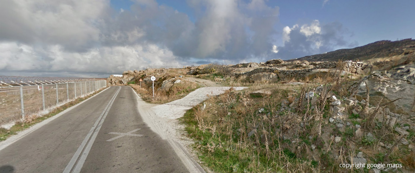
| WHERE | From spot 5 around the end of the runway (2 left turns) and take the road north along the airport fence. At the highest point after the upslope is a bay to the right for parking. Climb a bit higher and choose a spot that suits you the most. |
| WHAT | Overview of the beginning of the Rwy 34 with turntable and touch-down-area. |
| TIME | Sunrise to midmorning |
| MISC. | Nothing there. Good footwear recommended due to rocky soil. There is a small helicopter military base north of this location. Don’t get too close there so they cannot see you. Otherwise you will be in trouble. |
| FOCAL LENGTH | approx. 70 – 180mm. |


It might be wise to mention there is an air force base near spot #6 and that cameras are prohibited, it is important NOT to get close to it, if caught you WILL be in trouble. Apart from that good guide!
I left a note in the guide. Thanks for the useful info Alexandre.
-Julian